NYC rideshare demand map
Now I know where NYC gets busy — and I can decide before I drive.
tripvue shows Uber, Lyft & WAV drivers where trips cluster, by zone, hour, and day — from millions of real NYC trips. Plan your shift — now or hours ahead — instead of guessing.
Start with the free tier to see the map

Google Play and the Google Play logo are trademarks of Google LLC.
Based on real history. A typical pattern, not a guarantee.
Built for NYC today. Drive somewhere else? Tell us where →
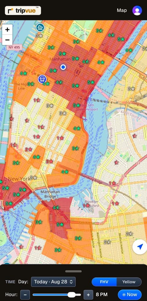
What you can do with it
Where do airport runs start? Where do the long trips come from?
Two taps recolor the whole map. Instead of where riders are in general, you see where the trips you actually want typically begin — hour by hour, across the week. A typical pattern from real trip records, not a guarantee.
Airport trips
Trips ending at JFK, LGA and Newark — and where those runs typically start, so you can be in the zone before the wave instead of chasing it.
Long trips
Trips over 10 miles. Fewer pickups, more miles on each one — and the zones that send them are not the zones that look busiest.
Cruise arrivals
Which terminal, which day, roughly how many passengers aboard, and the hours the wave actually comes off the gangway.
We’ll tell you when it gets busy
Turn on notifications and tripvue sends a heads-up before an airport typically heats up, and before a cruise ship docks at a terminal.
What keeps you going
Can you keep going?
Twelve hours in the seat is hard on a body. tripvue maps what keeps you going: relief stands where you can legally park and step away for up to an hour (free), restrooms with posted hours — updated by drivers who’ve actually been there — and EV chargers with the connector detail you need.
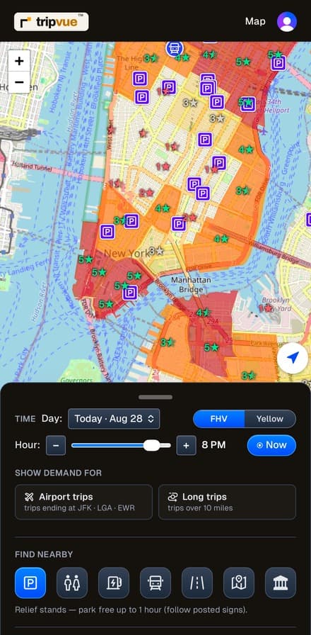
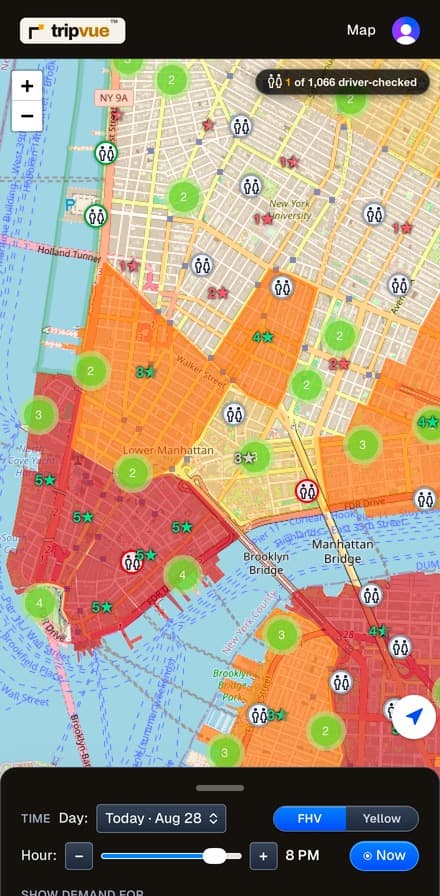
Community · Driver reports
Drivers keep it current
The amenity info gets better every shift, because drivers report what they find. Help other drivers — share a restroom’s status, a rating, and notes. Your report is posted here for other drivers to see.
The mission: city restroom data goes stale — drivers fix it at the door, one check at a time. Our goal: the driver-built record becomes the benchmark the city’s own data is measured against. That’s why restroom info is free for every driver, forever.
Restroom status
Reported by drivers, for drivers
Who built it
Built by an NYC driver who runs it every shift.
Not a startup guessing at your job — a working New York driver who also builds software, reading the city’s own trip records the way an engineer would, and driving on the result every night.
How it works
- 1
Pick a day and hour.
- 2
See where demand clusters across the city.
- 3
Drive there with one tap to Google Maps or Waze.
Simple pricing, no surprises
Free
$0
The next 3 days in busy-level colors (today: the next few hours), plus every restroom, relief stand & EV charger citywide — free forever, no card needed.
Premium — Monthly
$9.99/month
The full week, exact trips/hour, Zone Insights, airport & long-trip lenses, every amenity. 14-day free trial.
Premium — Annual
$79/year
Same Premium, 4 months free vs monthly. 14-day free trial.
| What you get | Free | Premium |
|---|---|---|
| Demand heat map — FHV & Yellow taxi | Next 3 days (today: next 3 hrs) | Full 7 days, every hour |
| 📊 Zone Insights — exact trips/hour, “% more trips than you”, where trips go, Uber/Lyft mix | — | Every zone, every hour, all week |
| ✈️ Airport trips lens — the map shows where airport-bound trips start | — | Included |
| 🛣️ Long trips lens — the map shows where 10+ mile trips start | — | Included |
| 📍 Places — hospitals, malls, hotels, venues | Nearby (2 mi) | All citywide |
| ☀️ Morning demand digest (opt-in notification) | Included | Included |
| Relief stands (park up to 1 hr) | All stands, citywide | All stands, citywide |
| EV chargers with connector detail | All 870+, citywide | All 870+, citywide |
| Restrooms with driver reports | All 1,000+, citywide | All 1,000+, citywide |
| 🏛️ Landmarks — the city's stories, museums, bridges | Included | Included |
| Train stations + live MTA alerts | Included | Included |
| ♿ Wheelchair-demand badges | Included | Included |
| Spot curb signals — driver-to-driver handoff | Coming soon | Coming soon |
Free is free forever — no card needed. Live MTA service alerts are never paywalled. Demand shown is a typical pattern from public TLC trip records, not a guarantee.
The trial needs a card and converts to a paid subscription automatically unless you cancel before it ends — we say so plainly at checkout, email you the terms and the first-charge date, and cancelling is one step, anytime. Prices in USD plus applicable sales tax (8.875% in NYC), itemized at checkout before you subscribe.
See plans — free for 14 days